The Boy Who Never Left His Room — And Mapped the Whole Country
There's a particular kind of restlessness that illness can't reach. The body might be pinned to a mattress, but the mind — given enough paper, enough ink, enough letters arriving from distant strangers — can travel anywhere.
John Melish knew this better than almost anyone.
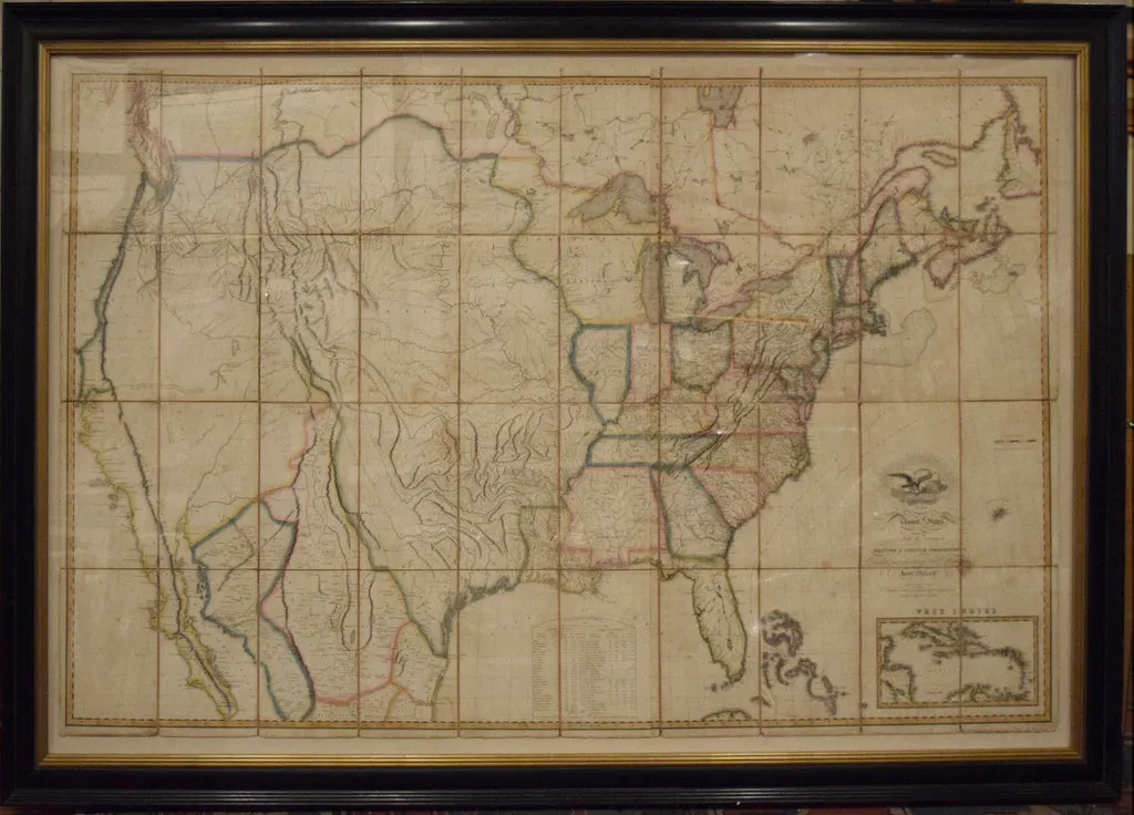 Photo: John Melish, via cdn.shopify.com
Born in Scotland in 1771 and eventually transplanted to Philadelphia, Melish spent years as a traveling merchant, crisscrossing the American interior with the eye of someone who couldn't stop noticing things — roads, rivers, the way a valley opened unexpectedly into a plain. He published travel journals that sold well. He had plans, always plans. And then his body stopped cooperating.
Chronically ill through much of his most productive decade, Melish did what restless, brilliant people often do when the world closes in: he went deeper into the one thing he could still control. He started drawing maps.
A Room Full of Letters
What made Melish remarkable wasn't raw artistic talent. Other cartographers of his era had steadier hands and more formal training. What he had was something rarer — a systematic hunger for information and an almost aggressive willingness to ask strangers for it.
From his Philadelphia home, he ran what amounted to an unofficial intelligence network. He wrote to surveyors in Kentucky and Georgia. He corresponded with military officers who had marched through territories most Americans couldn't name. He cross-referenced land office records with the journals of Lewis and Clark. He pestered government officials for data they hadn't thought to organize. Then he sat at his drafting table and tried to make sense of it all.
The America that was emerging in the early nineteenth century was, cartographically speaking, a mess. The Louisiana Purchase had nearly doubled the country's size overnight. Nobody agreed on where the Mississippi's tributaries ended or where Spanish territory began. Maps from different sources contradicted each other wildly. Some regions were documented in obsessive detail; others were represented by little more than hopeful guesswork.
Melish decided to fix that.
The Map That Moved a Nation
In 1816, he published what would become one of the most consequential maps in American history: Map of the United States with the Contiguous British and Spanish Possessions. It was enormous — nearly five feet wide — and it was different from anything that had come before it in one crucial way.
For the first time, the map showed the United States stretching all the way to the Pacific Coast.
This wasn't cartographic fantasy. Melish was careful, almost obsessively so, about distinguishing documented geography from inference. But the decision to frame the country as a continental entity — to draw its implied destiny right there on the paper — was a deliberate editorial choice. He believed Americans needed to see their country whole to understand what it could become.
Thomas Jefferson, who had spent years thinking about exactly this problem, wrote to Melish personally to praise the map. He called it the most accurate and useful representation of the country he had seen. Coming from the man who had commissioned Lewis and Clark, that was not a casual compliment.
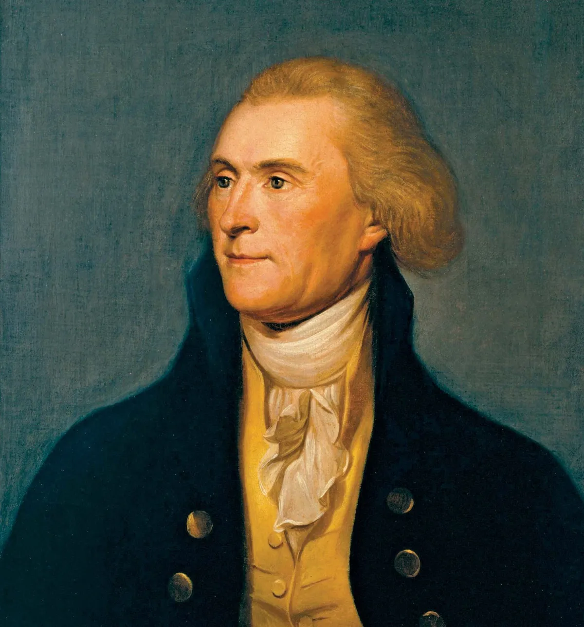 Photo: Thomas Jefferson, via cdn.britannica.com
The map went through multiple editions. It was used by diplomats negotiating treaties. It was consulted by generals planning campaigns. It was pinned to walls in offices and schoolrooms across the country. Settlers heading west used it to understand what lay ahead. In an era before photography, before telegraphs, before any of the tools we now take for granted for understanding space and distance, Melish's map gave Americans a picture of themselves.
The Paradox of Stillness
Here is the strange thing about all of this: Melish produced his most important work precisely during the periods when he was least able to move.
Illness forced him to rely on correspondence rather than direct observation. That limitation, which might have hobbled a lesser mind, turned out to be a kind of superpower. Because he couldn't go everywhere himself, he had to build systems for gathering information from people who could. He became a synthesizer rather than just a traveler — someone who could hold dozens of competing accounts in his head and extract the signal from the noise.
His sickroom became a kind of editorial office for the American landscape. Information came in from all directions. Melish sorted it, questioned it, compared it against other sources, and then — only then — committed it to paper.
This is not how we usually imagine great geographical achievement. We picture men with compasses hacking through undergrowth, fording rivers, sleeping under open skies. And those men existed and mattered. But Melish reminds us that someone had to make sense of what they found. Someone had to turn scattered observations into a coherent picture. That work — unglamorous, sedentary, conducted largely by correspondence — was just as essential as the expeditions themselves.
What the Maps Left Behind
Melish died in 1822, still in Philadelphia, still working. His later years brought financial difficulty; the map business was expensive to run, and he was not always a shrewd businessman. But the work outlasted the hardship.
The tradition he helped establish — rigorous, correspondence-driven, synthesis-focused American cartography — influenced the generations of mapmakers who came after him. His insistence on showing the country as a continental whole helped normalize the idea of westward expansion at a moment when many Americans still thought of the Appalachians as a meaningful boundary.
You could argue, without too much exaggeration, that Melish helped Americans imagine their way west before they actually went there.
Not bad for a man who spent half his career unable to leave the house.
There's a lesson somewhere in that — about the difference between movement and progress, between being present in a place and truly understanding it. Melish never stood on the banks of the Columbia River. He never crossed the Rockies. But he saw the whole country more clearly than almost anyone alive.
Sometimes the view from a sickroom window is wider than you think.